
Welcome to our comprehensive guide on engineering geology, where we delve into the intricate world beneath our feet. We bring you a wealth of information and insights as specialists in the industry to assist you in better understanding geological processes and their impact on engineering projects. This article is a wonderful resource for experts and fans alike, covering everything from site investigations to risk assessments.
Understanding Engineering Geology
Engineering geology is a multidisciplinary science that incorporates geological engineering, and geotechnical engineering principles. It focuses on analyzing a site’s geological features in order to determine its feasibility for various construction projects such as buildings, bridges, tunnels, and dams. Engineers can design structures that withstand environmental influences and assure long-term stability by studying a location’s geological qualities.
Read: How to Become a Geotechnical Engineer
Importance of Engineering Geology in Civil Engineering
Engineering geology is essential in civil engineering projects because it provides fundamental information and analysis that ensures the safety, feasibility, and longevity of structures and infrastructure improvements. The following are some of the main reasons why engineering geology is significant in civil engineering:
Learn More How to Become a Civil Engineer: A Step-by-Step Guide
Site Investigation
Engineering geology aids in determining the geological conditions of a site prior to construction. It entails investigating rock and soil properties, geological structures, groundwater conditions, and seismic activity. This data is critical for establishing the site’s suitability for construction and selecting relevant engineering solutions.
Foundation Design
Geological characteristics have a direct impact on the stability and load-bearing capability of foundations. Engineering geologists evaluate subsurface conditions and make foundation design recommendations. To guarantee that the foundations can sustain the structure efficiently, they analyze aspects such as soil strength, settlement potential, and groundwater levels.
Read: What is Foundation Engineering: Building Strong Structures
Slope Stability Analysis
Slope failures can be extremely dangerous to civil engineering projects. Engineering geology is important in analyzing slope stability because it investigates geological formations, soil qualities, and groundwater conditions. This aids in the development of suitable stabilization methods to prevent slope failures and landslides.
Excavation and tunneling
Engineering geology is essential for tunneling and excavation projects. It aids in assessing the qualities of the rock mass, identifying potential geological dangers, and choosing appropriate excavation procedures. This understanding is critical for assuring the safety of underground structures and reducing construction hazards.
Groundwater Management
Engineering geologists assess groundwater conditions to better understand how they affect civil engineering projects. Aquifer properties, water table changes, and potential pollution issues are among the factors they consider. This data is critical for planning effective drainage and dewatering systems, mitigating water-related problems, and protecting infrastructure structural integrity.
Learn More What is Water Resources Engineering
Construction Material Selection
Engineering geology aids in the selection of appropriate construction materials depending on the geological parameters of the site. The characteristics of various rocks and soils affect construction processes and material performance. Engineering geologists advise on the suitability, durability, and compatibility of materials with the geological environment.
Environmental Considerations
Engineering geology is used in environmental assessments and impact assessments. It aids in the identification of prospective geological hazards such as earthquakes, landslides, and soil liquefaction that may have an impact on the environment and adjacent communities. Engineers can design solutions to prevent negative impacts and ensure sustainable growth by recognizing these risks.
In a nutshell, engineering geology is critical in civil engineering because it provides vital insights into a site’s geological conditions, allowing engineers to make informed judgments, design structures effectively, and avoid potential geological risks. Civil engineers can improve project safety, durability, and overall success by incorporating engineering geology into the design and construction process.
Geological Engineering and Engineering Geology
Geological Engineering and Engineering Geology are two related but distinct fields within the broader discipline of geology and engineering. Here is a breakdown of the differences between the two:
Geological Engineering
The application of geological ideas and techniques to engineering projects is the emphasis of geological engineering. It entails the design, construction, and upkeep of structures and systems that interact with the geological elements and processes of the Earth. Civil engineering, geotechnical engineering, and environmental engineering are all incorporated within geological engineering.
Geological engineers use their geology knowledge to solve engineering problems involving subsurface conditions, geological dangers, and natural resources.
Engineering Geology
Engineering geology is a subfield of geology concerned with applying geological information and techniques to civil engineering projects. It entails the investigation of geological materials, their behavior, and potential geological risks that may impact construction and infrastructure development.
Engineering geologists collaborate with civil engineers and other specialists throughout the project lifecycle to provide geological knowledge and advice.
Geological engineering is a broader subject that includes the application of geological concepts to engineering projects, whereas engineering geology concentrates specifically on geological issues pertinent to civil engineering. Engineering geologists give specific geological expertise and support to civil engineering projects, whereas geological engineers have a more varied skill set and work on a variety of engineering projects.
Role of Geologists in Construction Projects
Geologists contribute significantly to construction projects by sharing their skills and knowledge of Earth’s elements and processes. Their participation contributes to the successful planning, design, and implementation of construction projects. Here are some of the important responsibilities that geologists play in construction projects:
Site Assessment
Geologists evaluate a construction site’s geological conditions, which include the type of rocks, soil types, groundwater conditions, and geological risks. They examine the history of the site, doing field surveys and laboratory tests to collect vital data. This information is critical for spotting potential problems and establishing the project’s viability.
Geological Mapping
Geologists generate geological maps that show the location and properties of rocks, soils, and other geological features near the construction site. These maps aid engineers in understanding subsurface conditions, identifying viable places for infrastructure development, and planning construction activities.
Geotechnical Investigations
To investigate the physical and mechanical qualities of soils and rocks, geologists perform geotechnical investigations. They conduct laboratory tests and evaluate soil samples to identify factors such as shear strength, compressibility, permeability, and bearing capacity. This data is critical for foundation design, slope stability studies, and determining the best construction methods.
Risk Assessment
Geologists evaluate geological hazards and potential threats to construction projects. They assess seismic activity, landslides, soil liquefaction, and groundwater variations, among other things. Geologists assist engineers in developing ways to successfully manage these hazards and assure the safety and stability of the structures by detecting and quantifying them.
Material Selection
Based on their understanding of the local geology, geologists assist in the selection of construction materials. They assess the appropriateness and durability of rocks, soils, and aggregates for a variety of construction applications. Geologists can also advise on the sourcing and quality control of construction materials in order to achieve optimal performance and prevent long-term maintenance difficulties.
Environmental Considerations
From a geological standpoint, geologists evaluate the environmental effects of construction projects. They assess the effects on ecosystems, water resources, and geological features. Geologists assist engineers in implementing environmentally friendly practices, adhering to regulations, and developing methods for reducing and mitigating environmental risks.
Monitoring and Remediation
Geologists may be in charge of monitoring systems to track geological and geotechnical conditions throughout construction. They measure ground movements, groundwater levels, and other pertinent characteristics with tools and methodologies. Geologists make advice for remediation actions to assure project safety and stability if unexpected geological difficulties develop.
Communication and Collaboration
Geologists collaborate closely with engineers, architects, and other construction professionals. They provide expert assistance and effectively communicate geological knowledge to support decision-making processes. Geologists also aid in the interpretation and use of geological data in engineering plans, guaranteeing a thorough understanding of the site conditions.
Geologists are essential in construction projects because they examine geological conditions, assess hazards, provide geotechnical expertise, and contribute to sustainable and safe construction techniques. Their participation ensures that projects are planned and carried out with complete awareness of the geological environment, resulting in successful outcomes and reduced geological hazards.
Geological Site Investigations: Assessing Subsurface Conditions
Before beginning construction projects, geological site investigations are required to analyze subsurface conditions. These investigations use a variety of tools and procedures to learn about the geological composition, properties, and potential risks of the site. Here are some important features of geological site investigations for analyzing subsurface conditions:
Desk Study
A desk study entails analyzing the site’s existing geological data, reports, maps, and records. This aids in gathering preliminary knowledge of the area’s geological history, regional geology, and identified risks. The desk research serves as the framework for subsequent field studies.
Field Surveys
Field surveys entail making firsthand observations and measurements on-site. Geologists inspect the site to evaluate the surface geology, geological structures, and any observable features that may have an impact on the project. They collect samples for laboratory examination and describe geological formations, soil types, and rock exposures.
Geophysical Methods
Geophysical techniques are used to gather subsurface data without the need for excavation. Seismic surveys, ground-penetrating radar (GPR), electrical resistivity tomography (ERT), and magnetometry are a few examples of these techniques. Geologists use the information gathered to infer subsurface characteristics such as rock layers, fractures, voids, or differences in soil qualities.
Borehole Investigations
Boreholes are dug to gain direct knowledge about subsurface conditions. Geologists choose drilling locations based on the needs of the site. They take soil and rock samples at various depths, allowing for extensive laboratory testing and analysis. Boreholes also give information for groundwater level assessments and in-situ testing such as cone penetration tests and pressure meter tests.
Laboratory Testing
Geologists conduct laboratory experiments on soil and rock samples gathered to assess their physical and mechanical qualities. Grain size analysis, moisture content, Atterberg limits, shear strength, consolidation, permeability, and other studies may be performed. These tests’ results give critical parameters for geotechnical analysis and design.
Geotechnical Analysis
Geologists examine the collected data to determine the site’s stability and load-bearing capabilities. They assess soil strength, compaction characteristics, groundwater conditions, and potential geological hazards such as landslides and sinkholes. The geotechnical analysis aids in the selection of appropriate foundation designs, slope stability measures, and construction processes.
Recommendations and Reporting
Geologists assemble the site investigation findings into a complete report. This report describes the geological profile of the site, including subsurface conditions, geological dangers, and design and construction suggestions. It is a helpful resource for engineers, architects, and other project experts.
Continuous Monitoring
Continuous monitoring of subsurface conditions may be required during and after construction in some circumstances. Geologists measure characteristics such as groundwater levels, soil settlement, and slope changes using instruments and monitoring systems. This continual monitoring ensures that any unexpected changes or dangers are detected as soon as possible.
Engineers and construction professionals can make educated decisions based on a full grasp of subsurface conditions by performing thorough geological site studies. These investigations aid in identifying potential issues, risk mitigation, and developing appropriate design and construction solutions, ensuring the safety, durability, and success of construction projects.
Understanding and Assessing Geological Hazards
Understanding and assessing geological hazards is an important component of geological studies, as it plays an important role in assuring the safety and sustainability of various projects and communities. Natural events or processes that potentially endanger human activities and infrastructure are referred to as geological hazards. Here are some crucial elements to remember when it comes to recognizing and assessing geological hazards:
Types of Geological Hazards: Geological hazards include a variety of phenomena, such as:
Earthquakes
The sudden release of energy in the crust of the Earth, causes ground shaking, earth rupture, and potential damage to structures.
Landslides
On slopes, the downward movement of soil, rock, or debris can result in harmful and devastating mass motions.
Volcanic Explosions
Volcanic eruptions, ashfall, pyroclastic flows, and lava flows can all have an impact on neighboring areas.
Sinkholes and subsidence
Ground settlement or collapse is caused by soluble rock breakdown, which frequently causes structural damage.
Rockslides and rockfalls
Rocks falling or sliding from cliffs or steep slopes, endangering infrastructure and human safety.
Floods
Rivers or coastal areas overflowing, frequently as a result of heavy rain or melting snow, causing significant damage.
Tsunamis
Large ocean waves caused by undersea earthquakes, volcanic eruptions, or landslides can wreak havoc on coastal areas.
Hazard Mapping
The assessment of the spatial distribution and possible severity of dangers in a specific area is part of geological hazard mapping. Geologists build danger maps by gathering and analyzing data on historical events, geological formations, terrain, and other pertinent aspects. These maps give information on locations that are vulnerable to various hazards and can be used to influence land-use planning, infrastructure design, and emergency preparedness.
Hazard Assessment
The goal of hazard assessment is to comprehend the features and probable consequences of geological hazards. Geologists evaluate possible occurrences based on characteristics such as frequency, size, speed, and extent. They take into account geological, topographical, and meteorological aspects, as well as the vulnerability of exposed items (for example, buildings, infrastructure, and people). This evaluation helps to determine the amount of risk and establish appropriate risk mitigation solutions.
Early Warning Systems
Early warning systems for geological hazards such as earthquakes and tsunamis can provide critical time for evacuation and emergency response. Geologists help to create and execute these systems by monitoring seismic activity, evaluating data from geodetic devices, and coordinating with seismologists and other experts to increase warning accuracy and timeliness.
Risk Management and Mitigation
Geologists play an important role in geological risk management and mitigation measures. They work with engineers, urban planners, and policymakers to incorporate risk assessments into land use planning, infrastructure design, and building codes. Geologists help to create engineering solutions such as slope stabilization techniques, seismic design guidelines, and flood control structures. They also help with public awareness initiatives, disaster preparation, and response planning.
Continuous Monitoring
Geological dangers can alter over time due to tectonic activity or climatic change, for example. To discover and track any growing dangers, geologists use continuous monitoring techniques. Monitoring seismic activity, ground movements, slope stability, and changes in water levels are all part of this. Continuous monitoring aids in the updating of hazard assessments as well as the provision of timely information for risk management and emergency response.
Geologists help to build resilient communities and infrastructure by studying and assessing geological hazards. Their knowledge aids in informed decision-making, effective risk management, and the execution of mitigation measures to reduce the effects of geological hazards on society and the environment.
Soil Mechanics: An Important Aspect of Engineering Geology
To better understand how soil behaves under various loads and situations, engineers and geologists study its physical and mechanical qualities. They look into things such as soil composition, grain size distribution, compaction, shear strength, and permeability. This knowledge is useful in determining the suitability of soil for construction and in designing stable foundations, earthworks, and retaining structures. Soil mechanics is important in analyzing settlement, evaluating slope stability, and devising geotechnical solutions for a variety of infrastructure projects.
Learn More about Soil Mechanics
Rock Engineering and Mechanics
The study of rock behavior and the mechanical characteristics of rock masses are the main topics of rock mechanics. Rock strength, deformation properties, jointing patterns, and rock mass stability are all elements that engineers and geologists consider. This knowledge is essential for planning tunnels, subterranean excavations, and rock slopes, as well as developing rock reinforcement and stabilizing technologies. The selection of suitable excavation techniques, support systems, and rock blasting procedures is also guided by rock mechanics. Understanding rock and rock mass dynamics is critical for assuring the safety and durability of rock engineering projects.
Slope Stability and Landslide Analysis
Slope stability analysis is an important topic of engineering geology, especially in places prone to landslides or steep slopes. Geologists and engineers evaluate the geological and geotechnical elements that determine slope stability, such as rock or soil type, slope geometry, groundwater conditions, and external stresses. They can detect probable collapse processes, assess safety factors, and design stabilizing solutions such as retaining walls, slope drainage systems, and erosion control measures by conducting extensive slope stability analyses. Landslide analysis and mitigation measures serve to reduce the danger of slope failures, protecting infrastructure as well as human life.
Hydrogeology and Groundwater in Engineering Projects
By investigating the movement, distribution, and behavior of groundwater, hydrogeology plays an important role in engineering projects. Groundwater levels, flow patterns, recharge rates, and groundwater-surface water interactions are all evaluated by hydrogeologists. This data is critical for understanding the effects of groundwater on building sites, such as changes in soil moisture content, pore pressure, and seepage potential. Hydrogeological data is used by engineers and geologists to build effective drainage systems, dewatering methods, and foundation solutions. Groundwater management is critical for guaranteeing excavation stability, reducing water-related damage to structures, and preserving the long-term integrity of infrastructure projects.
Professionals may make educated decisions, develop appropriate designs, and execute effective geological solutions by including soil mechanics, rock mechanics, slope stability analysis, and hydrogeology in engineering geology. These disciplines give the tools and knowledge required to manage risks, assure project safety, and produce long-term and successful outcomes in a variety of engineering projects.
Environmental Considerations in Engineering Geology
Environmental concerns are important in engineering geology because they include the assessment and management of the environmental implications of building and infrastructure development. Following are some essential points about environmental considerations in engineering geology:
Environmental Site Assessments
To determine the presence of pollutants or hazardous compounds in the soil, groundwater, or surface water, engineering geologists undertake environmental site evaluations. They examine the history of land usage, identify potential pollution sources, and estimate the degree and impact of any existing contamination. This knowledge is critical for safeguarding human health, ecosystems, and natural resources.
Soil and Water Quality Monitoring
Before, during, and after construction projects, Engineering Geologists monitor the quality of the soil and water resources. They look at things like pH, heavy metal concentrations, nutritional content, and the existence of organic molecules. They can identify any negative environmental impacts and adopt suitable mitigation steps by monitoring soil and water quality.
Erosion and Sediment Control
Engineering geologists help to develop and implement erosion and sediment control methods. They evaluate the erosion vulnerability of construction sites, determine sediment transport paths, and design erosion control structures such as retaining walls, sediment basins, or vegetative buffers. These strategies serve to prevent sediment from entering bodies of water, protect aquatic habitats, and maintain water quality.
Habitat Preservation and Biodiversity Conservation
Engineering geologists assess the potential impacts of construction projects on natural habitats and biodiversity. Within project regions, they identify sensitive ecosystems, endangered species, and crucial habitats. They can minimize disturbance to these areas and establish mitigation techniques to maintain and increase biodiversity by incorporating this information into project planning.
Wetland Assessment and Restoration
Wetlands are vital ecosystems that provide crucial ecological benefits. Wetland regions inside project sites are evaluated by Engineering Geologists to establish their ecological value and potential implications. In accordance with legal requirements, they design measures to minimize or compensate for wetland loss, such as wetland construction or restoration activities.
Sustainable Land Use Planning
Engineering geologists contribute to sustainable land use planning by considering the long-term environmental implications of projects. They evaluate the suitability of land for various applications, assess contamination risk, and identify environmentally sensitive locations. This data informs judgments on site selection, project design, and mitigating strategies.
Compliance with Environmental Regulations
Engineering geologists play a role in ensuring compliance with environmental regulations and permits. They collaborate closely with regulatory bodies to get required permits and approvals, monitor environmental parameters, and address any environmental problems or breaches that may develop during construction.
Professionals can reduce the environmental imprint of projects, safeguard ecosystems and natural resources, and promote sustainable development by including environmental considerations in engineering geology. Engineering geologists help to preserve the environment and the overall well-being of current and future generations by proactively solving environmental challenges.
Engineering Geology in Action: Case Studies
Case Study 1: Gotthard Base Tunnel, Switzerland
The Gotthard Base Tunnel in Switzerland is one of the longest railway tunnels in the world, stretching 57 kilometers into the Swiss Alps. Due to the complex and different rock formations encountered throughout the tunnel path, the project offered major geological obstacles. Engineering geology played a crucial role in the successful construction of the tunnel.
Geological investigations were conducted to assess the rock mass conditions, including the presence of fault zones, water-bearing formations, and rock strengths. Squeezing earth, rock explosions, and significant water inflows were identified as potential concerns thanks to detailed geological mapping and rock core sampling.
Based on the findings, engineering solutions were put in place. Tunnel boring equipment equipped with improved cutter heads and automatic probing systems, for example, were employed to navigate through diverse rock formations. Rock support systems, including shotcrete, rock bolts, and steel arches, were designed to ensure stability in challenging rock masses.
Case Study 2: Three Gorges Dam, China
The Three Gorges Dam, located on the Yangtze River in China, is one of the largest hydroelectric power projects in the world. Engineering geology considerations were critical in the design and construction of this megastructure, which necessitated a thorough knowledge of geology and geological risks in the area.
The project involved the excavation of deep foundation trenches and the construction of an enormous concrete gravity dam. Engineering geologists carried out detailed investigations to evaluate the geological conditions, which included the presence of faults, unstable rock masses, and probable landslide zones.
Through geological mapping, seismic surveys, and drilling programs, the project team gained valuable insights into the subsurface conditions. The findings influenced the dam’s foundation design, rock reinforcement measures, and slope stability assessments. Assessing seismic hazards was also critical in engineering the dam to resist future earthquakes.
Case Study 3: Dubai Palm Islands, UAE
The Palm Islands in Dubai, United Arab Emirates, are artificial islands constructed in the shape of palm trees that extend into the Arabian Gulf. In the development and building of these large offshore projects, engineering geology issues were critical.
Geotechnical investigations were conducted to evaluate the seabed conditions, including the nature of the underlying sediments, their bearing capacity, and the potential for liquefaction during construction and in response to seismic events. Engineering geologists were crucial in assessing the project’s environmental consequences, which included maintaining marine habitats and minimizing sedimentation.
Based on the findings, innovative engineering solutions were implemented. Vibro-compaction and stone columns were used to improve the stability of the sandy seabed and to strengthen the foundation support for the island constructions. Geotextile materials were used to protect against erosion and stabilize coastal areas.
These case studies demonstrate the critical role of engineering geology in real-world projects. Engineering geologists assist to the successful completion of infrastructure projects while guaranteeing safety, sustainability, and environmental stewardship by conducting detailed geological investigations, analyzing hazards, and applying appropriate engineering solutions.
Future Trends in Engineering Geology
Future trends in engineering geology are shaped by advancements in technology, evolving environmental concerns, and the need for sustainable and resilient infrastructure. The following are some important future trends that are anticipated to have an impact on the discipline of engineering geology:
Integration of Remote Sensing and Geospatial Technologies
Remote sensing techniques such as satellite images, LiDAR, and aerial surveys are becoming more affordable and accessible. These technologies provide precise and up-to-date data on topography, land cover, and geological features. The integration of remote sensing data with geospatial technologies allows for more precise geological mapping, hazard assessment, and natural phenomenon monitoring.
Artificial Intelligence (AI) and Big Data
Large databases, paired with AI algorithms, will change engineering geology. AI can assist in the analysis of massive volumes of geological data, the identification of trends, and the prediction of geological risks. Machine learning algorithms can help with the interpretation of geophysical and geotechnical data, the optimization of construction plans, and the improvement of risk assessment models.
Climate Change Resilience
As the effects of climate change become more severe, engineering geology will play a critical role in assessing and managing climate-related risks. This involves assessing the impact of increasing sea levels, changing precipitation patterns, and an increase in the frequency of extreme weather events on infrastructure projects. In order to preserve infrastructure from future climatic impacts, engineering geologists will need to incorporate climate change estimates into their calculations.
Geotechnical Solutions for Sustainable Construction
Sustainable construction practices are gaining prominence, and engineering geology will contribute to the development of environmentally friendly geotechnical solutions. This may include the use of recycled materials, geosynthetics, and new ground improvement techniques to reduce environmental impacts, optimize resource consumption, and increase infrastructure projects’ long-term sustainability.
Geohazard Mapping and Early Warning Systems
Geospatial technology advancements and real-time monitoring systems will improve geohazard mapping and early warning capabilities. To continuously monitor slopes, landslides, earthquakes, and other geological risks, Engineering Geologists will use modern monitoring techniques like remote sensing, sensor networks, and geotechnical instrumentation. This information will assist in the development of effective early warning systems, allowing for timely evacuation and mitigation measures.
Resilient Urban Planning
The expansion of urban areas and their increased vulnerability to natural disasters need a comprehensive approach to urban planning. Engineering geology will help in identifying acceptable construction sites, assessing geological dangers, and designing robust infrastructure systems. It will also offer important insights into sustainable land use planning, subsurface space usage, and the incorporation of green infrastructure to improve urban resilience.
Geothermal Energy Exploration
As the world moves toward cleaner energy sources, geothermal energy is gaining popularity. Engineering geologists will be essential in locating and evaluating geothermal resources, as well as assessing reservoir features and constructing efficient and sustainable geothermal energy extraction systems. They will help to advance geothermal energy as a reliable and green energy source.
These future engineering geology trends highlight the field’s continual growth, spurred by technological advancements and the need to address environmental and socioeconomic concerns. Engineering geologists can help the construction of resilient, sustainable, and safe infrastructure for future generations by adopting these themes.
Conclusion
In conclusion, engineering geology is a critical discipline that plays a pivotal role in the planning, design, and execution of infrastructure projects. Engineering geologists give essential insights that contribute to the safe and sustainable development of construction projects by their understanding of geological processes, assessment of site conditions, and identification of possible risks. Engineering geologists contribute to the long-term effectiveness and resilience of infrastructure in various geological contexts by utilizing their expertise in areas such as soil mechanics, rock mechanics, slope stability studies, and environmental issues.
Engineering geology is evolving as a result of technological breakthroughs, the growing importance of environmental considerations, and the need for sustainable solutions. Integration of remote sensing and geospatial technologies, the application of artificial intelligence and big data analytics, and the focus on climate change resilience are among the future trends that will shape the discipline. Engineering geologists will continue to play an important role in the development of infrastructure that is not only safe and functional but also environmentally conscientious and resilient to geological hazards by embracing these trends and addressing the difficulties of our fast-changing world. Their expertise will be indispensable in ensuring the sustainable development of our built environment while preserving the integrity of our natural surroundings.
FAQs
The application of geological information and concepts to engineering projects is known as engineering geology. It entails researching a site’s geological conditions in order to analyze potential risks such as landslides, rockfalls, or soil instability and make recommendations for safe and cost-effective buildings.
An engineering geologist is in charge of conducting site surveys, assessing geological hazards, analyzing soil and rock qualities, designing foundations, and making construction project recommendations. During and after construction, they also monitor and manage geological risks.
Engineering geology is important in construction projects because it provides vital information about the geological conditions of a site. This knowledge enables engineers and designers to make informed judgments about site selection, foundation design, slope stability, groundwater conditions, and other aspects that can affect structure safety and longevity.
Geological mapping, drilling, sampling, laboratory testing of soil and rock samples, geophysical surveys, and remote sensing techniques are all used in engineering geology research. These approaches provide information for appraising a site’s geological features and potential risks.
Engineering geologists examine the geological makeup, structure, and stress levels of slopes to determine slope stability. They assess the stability of slopes and detect potential landslide or slope failure threats by analyzing the strength of soil and rock components, water content, and pore pressures.
Engineering geology aids in foundation design by examining subsurface factors such as soil and rock qualities, groundwater levels, and the possibility of settlement or subsidence. This information is critical for selecting appropriate foundation types and determining foundation depth and dimensions.
During earthquake activity, saturated soils lose their strength and behave like a liquid, a process known as liquefaction. Engineering geologists examine the risk of liquefaction by examining the soil’s composition, density, and water content, as well as the region’s seismicity. They make advice for reducing the danger of liquefaction during construction.
Engineering geology aids in the detection of potential geological risks such as faults, weak rock formations, groundwater inflows, and ground instability in tunneling projects. Engineering geologists examine geological conditions to make recommendations for tunnel design, support systems, and excavation methods that are safe and efficient.
By assessing the potential geological risks connected with construction projects, engineering geology contributes to environmental impact assessments. Assessing the impact on water supplies, ecosystems, and natural geological features is part of this process. There are recommendations to limit negative consequences and establish appropriate mitigation strategies.
Engineering geology is critical in assessing natural risks such as landslides, earthquakes, volcanic activity, and coastal erosion. Engineering geologists can identify places prone to these dangers and offer land-use planning and hazard mitigation techniques by examining the geological history and existing circumstances.
Engineering geology is important for the design of retaining structures like retaining walls and slope stabilization techniques. Engineering geologists evaluate the right design parameters and construction procedures for these structures by evaluating soil and rock qualities, groundwater conditions, and slope stability.
Engineering geology is important in groundwater exploration because it evaluates an area’s geological formations and hydrogeological features. This data assists in identifying possible aquifers, estimating groundwater availability, and designing appropriate extraction systems for long-term water resource management.
Engineering geologists evaluate the danger of soil contamination by examining a site’s geological and hydrogeological properties. They assess the presence of probable contamination sources, soil permeability, and groundwater flow patterns to establish soil sensitivity to pollution and, if necessary, devise remediation plans.
Engineering geology aids in the knowledge of coastal processes, sediment transport, and shoreline evolution in coastal engineering projects. This knowledge aids in the construction of coastal protection measures, harbor structures, and erosion management tactics to enable sustainable coastal development.
Engineering geology assesses geotechnical hazards in urban areas by studying the subsurface conditions, including soil and rock properties, groundwater levels, and potential for ground settlement or subsidence. This information is critical for identifying high-risk regions and putting proper safeguards in place to protect buildings, infrastructure, and the general public.
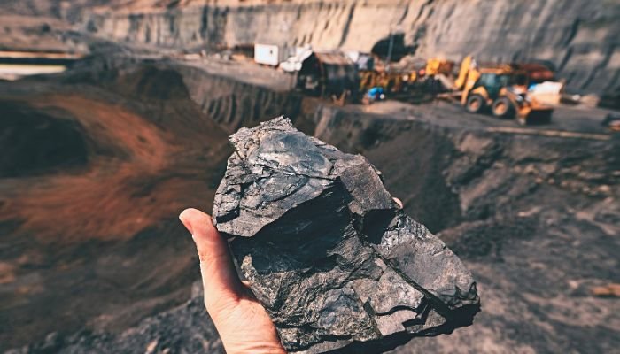
The discovery and extraction of mineral resources in the mining industry are crucially influenced by engineering geology. Engineering geologists assist in the identification of probable mineral deposits, the assessment of mine slopes and underground excavations, and the provision of advice for waste management and environmental protection during mining operations.
Engineering geology helps geotechnical modeling by supplying parameters and data for numerical simulations and analysis. Soil and rock qualities, groundwater conditions, and geological formations are all included. Geotechnical models assist engineers in understanding ground behavior and optimizing design solutions for various engineering projects.
Engineering geology is important in disaster management because it assesses geological risks and makes recommendations for risk reduction and catastrophe preparedness. It aids in the planning and implementation of mitigation measures for natural disasters such as earthquakes, landslides, and floods on infrastructure and human life.
Engineering geology helps to preserve cultural heritage places by examining geological conditions and potential hazards that may affect historical constructions or archaeological sites. This understanding aids in the development of conservation methods, the stabilization of unstable buildings, and the protection of cultural assets from geological dangers.
Given the increasing demand for infrastructure development, urbanization, and sustainable resource management, the future prospects for engineering geology look bright. The integration of advanced technologies such as remote sensing, geophysical imaging, and numerical modeling will further enhance the capabilities of engineering geologists in assessing and managing geological risks in engineering projects.